


AP Geography classes use mapping software to supply aid
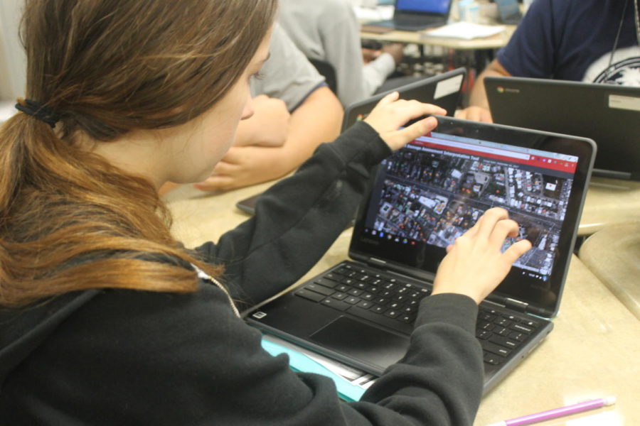
Students use Geographic Information Systems to find areas of damage after Hurricane Maria
November 30, 2017
When students enrolled in AP Geography this year, they had no idea that they would be helping with the recovery effort in Puerto Rico after Hurricane Maria devastated much of the Caribbean Islands.
Geography teacher Maribel Velez Ramos has personal ties to Puerto Rico, where she was born and where her parents still live. When her homeland was hit by the hurricane, she put a plan in place in which she could teach her students how to use Geographic Information Systems software to help real people who have lost their homes and do not have access to electricity or drinkable water.
Ramos said her class was invited by the GIS company ESRI to help with a mapping project, where students analyze satellite images to mark the condition of buildings in Puerto Rico with different color dots. Using ESRI software, they mark buildings based on damage. Destroyed buildings are marked red, partially damaged are marked orange and buildings with no damage are marked green.
“What we’re going to be doing is a contribution to speed the relief efforts over there,” Ramos said. “After we put together the map — which we hope to use this map — soon the (Federal Emergency Management Agency will have) people with iPads in Puerto Rico validating the map.”
Senior Caitlin Spence is a student who has become excited about the Puerto Rico mapping project. She said she has also helped people using a service called Crowd Rescue that lets people re- port requests and searches social media for calls for help if they can’t reach 911.
“ It will just help teach people that there’s never nothing you can do,” Spence said. “You can always go out and help people and you can’t just say ‘oh well I don’t know how to.’ ere’s always a way to help people.”
All students in her classes were required to map a single town with 70 dots; however, Senior Anthony Christian has gone beyond the requirement, marking more than 200 in different towns across the island. Christian said the impact of the hurricane was tremendous.
“A lot of people don’t get a chance like this (to help), especially with something so big on a big scale,” he said. “I think it’s inspiring for a lot of people.”
Ramos said that with hurricanes striking the United States more frequently, it is important for students to learn to use the technology.
“We have to learn from this event. So next time we can act faster and we can help and geo-technology is available to help us speed the process of recovering our relief,” Ramos said. “And I want the kids to know that this is the future of emergency management.”